|
|
Survey route design, parameter adjustment in automatic and
manual modes
|
|
|
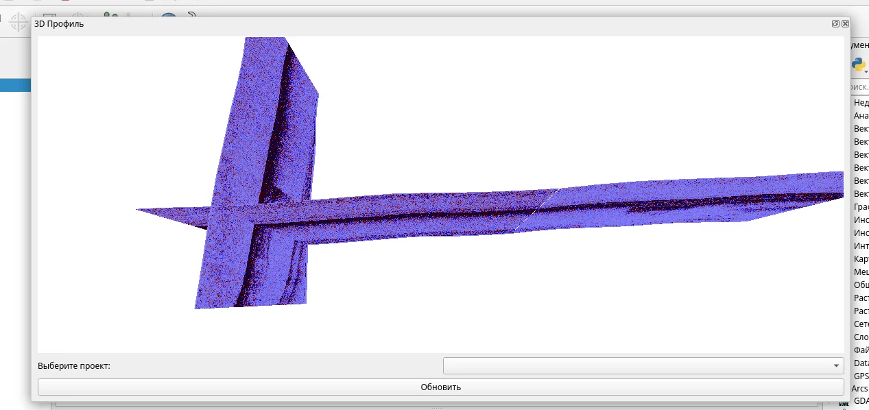
Trajectory tracking and visualization of survey data in real-
time
|
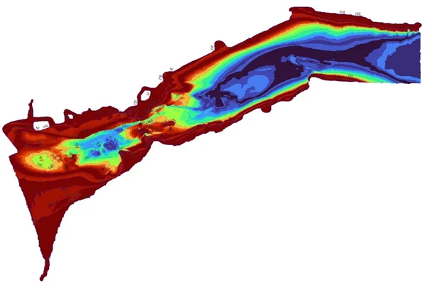
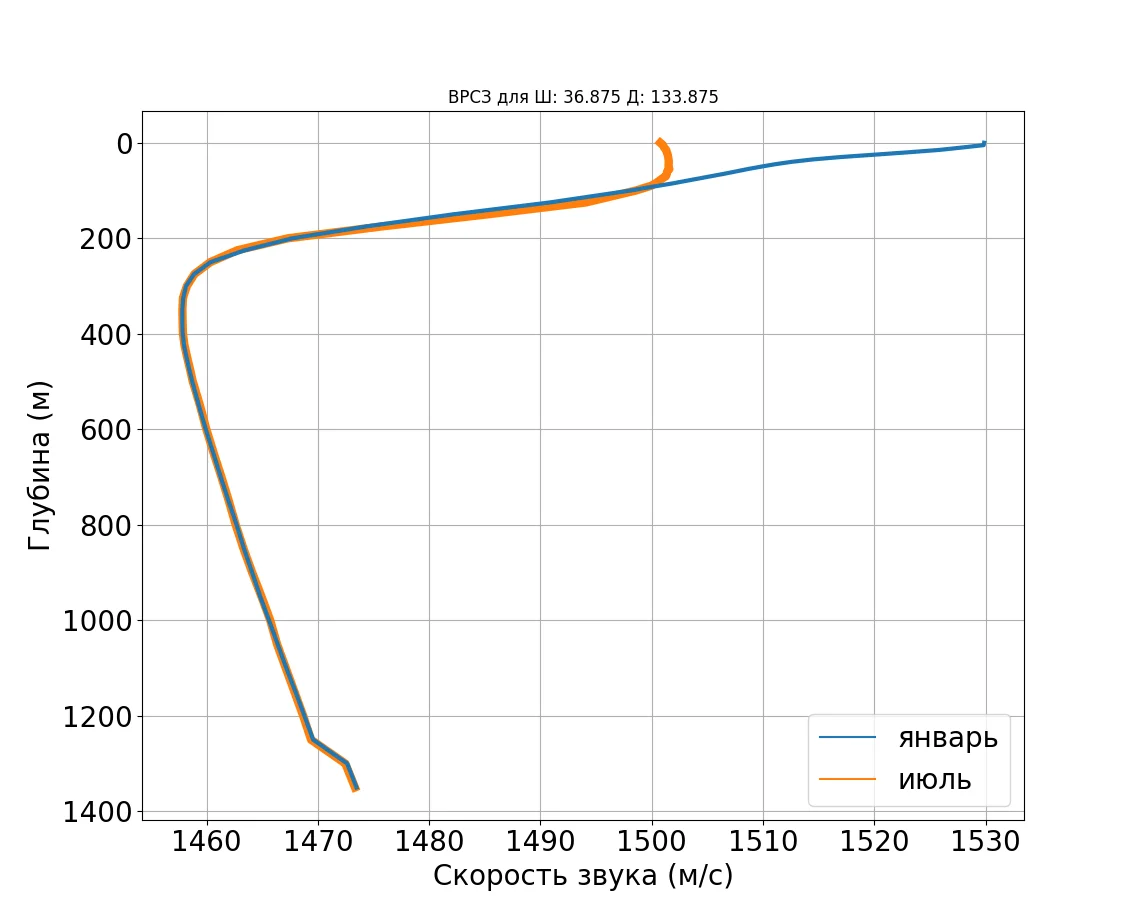
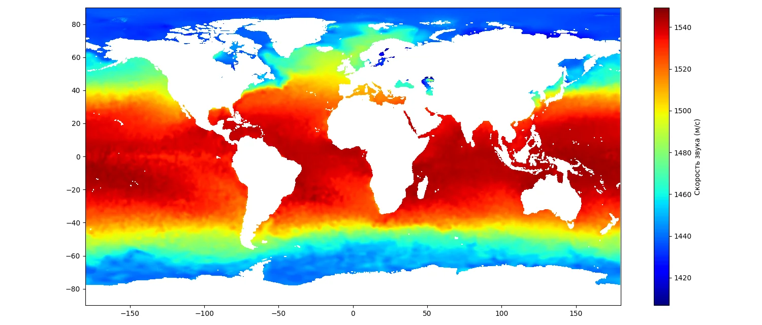
Visualization of
hydroacoustic data
|
2D and 3D views, cross-sections, comparisons
|
|
|
Archive of monthly-averaged observations across the global
ocean
|
Compatible data
transformation
|
Conversion between international formats (json, csv, tif,
netCDF, SEG-Y, shp, etc.)
|
|
|
Noise reduction, error correction, data interpolation, gridding
methods, etc
|